Showing posts with label 900 miler club. Show all posts

Tuesday, July 19, 2011

Smokies Hikes

Hepatica


 I spent 5 days camping with the family in Cades Cove last week and managed to get two good loop hikes in towards my goal of hiking all the trails in the GSMNP.

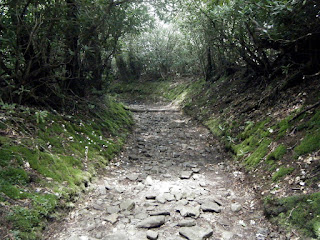
On 7/8, I rode my bicycle to the Anthony Creek Trail head at the top of the picnic area. I followed this pretty trail for 1.6 miles and then veered right at the junction of  the Russell Field Trail. This trail follows the Left Prong of Anthony Creek (crossing it a few times on foot logs.) The trail passes some impressive old growth trees and climbs steadily to join the Appalachian Trail at the new Russell Field Shelter. I spotted several bear tracks in the mud on my hike up. I ate a quick lunch at the shelter while reading the shelter journal and then hiked north on my familiar old Appalachian Trail to the beautiful Spence Field. Here, I joined the Bote Mountain trail, and I drank my fill of ice cold water from a wonderful spring just a hundred yards or so below the ridge. This is an interesting old road, deeply ravined and rocky. The elevation dropped quickly in the 1.6 miles before I joined back with the Anthony Creek Trail to hike 3.6 miles back down to the Cades Cove Picnic area. About 1/2 mile from the trailhead, the skies opened up with a drenching rain and I ended my hike completely soaked.
Miles Hiked: 13.4

                                                                Russell Field Shelter
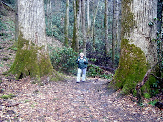
                                                         50 inch Northern Red Oak


On 7/11, I returned by bicycle to the Anthony Creek trailhead to do another loop hike. This time, I hiked Anthony Creek back to the Bote Mountain Trail and then turned left (downhill) on Bote Mountain. I followed it down to the little Lead Cove Trail which I followed down to its end at Laurel Creek road. I crossed the road and hiked 2/10 of a mile on Turkeypen Ridge to join up with the Crib Gap Trail. As I hiked this low-elevation, road-skirting, non-descript trail through the deep heat and humidity of the day, I told myself that I would never remember anything about this trail unless I happened to see a bear. About five minutes later, I made eye contact with a black bear who promptly exited the trail! I guess I will remember Crib Gap Trail after all. Crib Gap joins Anthony Creek to complete the loop.
Miles Hiked: 8.8


                                                                   Bote Mountain Trail
                                                                 Bote Mountain Trail

Tuesday, June 28, 2011

Flat Creek and Spruce Mountain Trail

Black Betty tagged along today for a little Smokies adventure which involved hiking two separate trails and working in a bicycle shuttle to boot.

To start with, we drove to the Heintooga picnic area and left our bikes at the trail head for the Flat Creek trail. Then we drove back down Heintooga Ridge Road to the southern trail head and hiked north on the beautiful and moderate Flat Creek Trail.

This trail was actually built in 1934 by the C.C.C. and still seems to receive regular maintenance. And if you can believe it, the lush grass which borders the trail for most of its 2.6 miles seemed to have been very recently weed whacked! We certainly enjoyed the beauty of the pristine creek and surroundings and the rather gentle grade of the trail in general. This would be a great one to take kids hiking on.


When we reached the picnic area, we hopped on our bikes and rode downhill 3 1/2 miles to the car.


Next, we drove the one-way Balsam Mountain Road about 6 miles to the Spruce Mountain Trail. Interestingly enough, we saw a turkey hen with about a dozen little chicks and then a ruffed grouse hen with several chicks while driving between the hikes. 

Spruce mountain trail is a short and sweet 1 miler which runs up to the junction of the now closed Polls Gap Trail. It featured a pretty little stream crossing and several large beeches, yellow birches, and red spruce trees. I hiked the 2/10 mile to campsite #42 to check it out. Distant thunder and threatening skies prevented us from hanging out too long so we headed back down hill to the car.


Friday, June 24, 2011

Gregory Bald Hike

I hiked up to Gregory Bald in the Great Smoky Mountain National Park yesterday via the Gregory Ridge Trail. I drove through a persistent rain the entire way to the trail head on Forge Creek Road in Cades Cove, but the rain let up just as I was starting my hike.

The trail provided a pretty and pleasant hike. It ambled gently for the first two miles along Forge Creek eventually crossing it three times on foot logs. The walk through beautiful stands of in-bloom rosebay rhododendrons, old-growth hemlocks, and tuliptrees was magnificent to say the least.

The climb really starts at campsite 12, where you begin the 2400' climb (over 3 miles) up Gregory Ridge to Rich Gap. Although this works out to about 800' gain each mile, the climb really didn't seem too bad to me on this particular day. I guess I must have remembered to eat my Wheaties for breakfast. The thrill of the hike came about 1/2 mile below Rich Gap when I encountered a LARGE BLACK BEAR heading downhill on the same trail that I was heading uphill on. The bear behaved exactly like I wanted it to and promptly exited the trail with a loud crashing lope through the woods as soon as it saw me.

At Rich Gap, I joined the Gregory Bald trail for a short and easy 6/10 mile hike to the Bald. At this point, the mountain was enshrouded in heavy cloud with very limited visibility which was a bit of a disappointment. It made it difficult to fully appreciate this 10 acre open grassy bald situated on the Tennessee / North Carolina border for what it really is.  The famous Gregory Bald display of azaleas were a bit beyond their prime but the colors were still brilliant and beautiful. In spite of the heavy fog and mist, I was able to spot azaleas blooming in oranges, reds, pinks, yellows, whites, creams, and various combinations  The fragrance in the air was magnificent. I must say I don't remember ever encountering anything like it in all my years of hiking.

I think that I will have to return later this summer to enjoy some of the many blueberries scattered about the bald. Maybe I'll luck out and get a view next time.

Overall, I will have to rate this 11 mile round trip as a must do!


As an Appalachian Trail through hiker, I feel that I must also mention that the Appalachian Trail originially crossed Gregory Bald on its route through the Smokies. The relocation to the current route took place in 1948.

                                                   
 1940 Great Smoky Mountain map showing the Appalachian Trail crossing Gregory Bald.

Monday, February 28, 2011

Ramsey Cascades Trail - Big Trees and Waterfalls

We hiked to Ramsey Cascades in the Greenbriar section of the GSMNP yesterday. The trail is 4.0 miles long resulting in an even 8 mile round trip. We had rain showers on and off for the entire day but fortunately it was seasonably warm for the end of February with temps in the 60's.

The first 1-1/2 miles of the trail follows a gentle climb and smooth foot path along side the Middle Prong of the Little Pigeon River. The remaining 2-1/2 miles of trail climbs along the Ramsey Prong. Here is where the slippery roots and rocks join with a more aggressive elevation gain making the hike a little more challenging.
Several old growth giants line the trail, including some massive tulip poplars and eastern hemlocks. The trail is in good shape with lots of stone steps and a couple of  long creek crossing foot bridges. It's evident that a lot of work has been done on this trail over the years.

At the top of the trail is the beautiful Ramsey Cascades. It is a 90 foot cascading waterfall and according to the little brown guidebook, Hiking Trails Of The Smokies Ramsey Cascades is the highest waterfall in the park accessible by trail. It really is a spectacular sight and I'm sure that it gets crowded in the summer. There is a huge flat rock in front of the falls positioned perfectly for viewing. We didn't eat lunch there because of the cool spray and wind coming off the falls but I'll bet in sunnier weather that would be the spot.

This trail gains around 2200' in 4 miles. Black Betty rated it difficult. I would give it 2-3 Snickers bars using Nimblewill Nomad's  rating system. The rain did make the roots slippery and Black Betty fell on the way down spraining her knee. She was able to walk out so lucky for her I didn't have to tote her like a sack of potatoes.