|
| The view from Grandview Trail head. |
I just couldn't resist another shot at backpacking the Grand Canyon, so back in the summer when my hiking buddy, Boy Floyd, said that he was off for Thanksgiving week, I said, "Let's plan another hike."
He made the arrangements with the Park's Backcountry office and obtained the permit which would allow us a trip on the eastern side of the Tonto Trail. We had a 5 day, 4 night trip planned. We were joined by another Appalachian Trail hiking friend, by the name of Groceries.
 |
| Hometown, Groceries, Boy Floyd. |
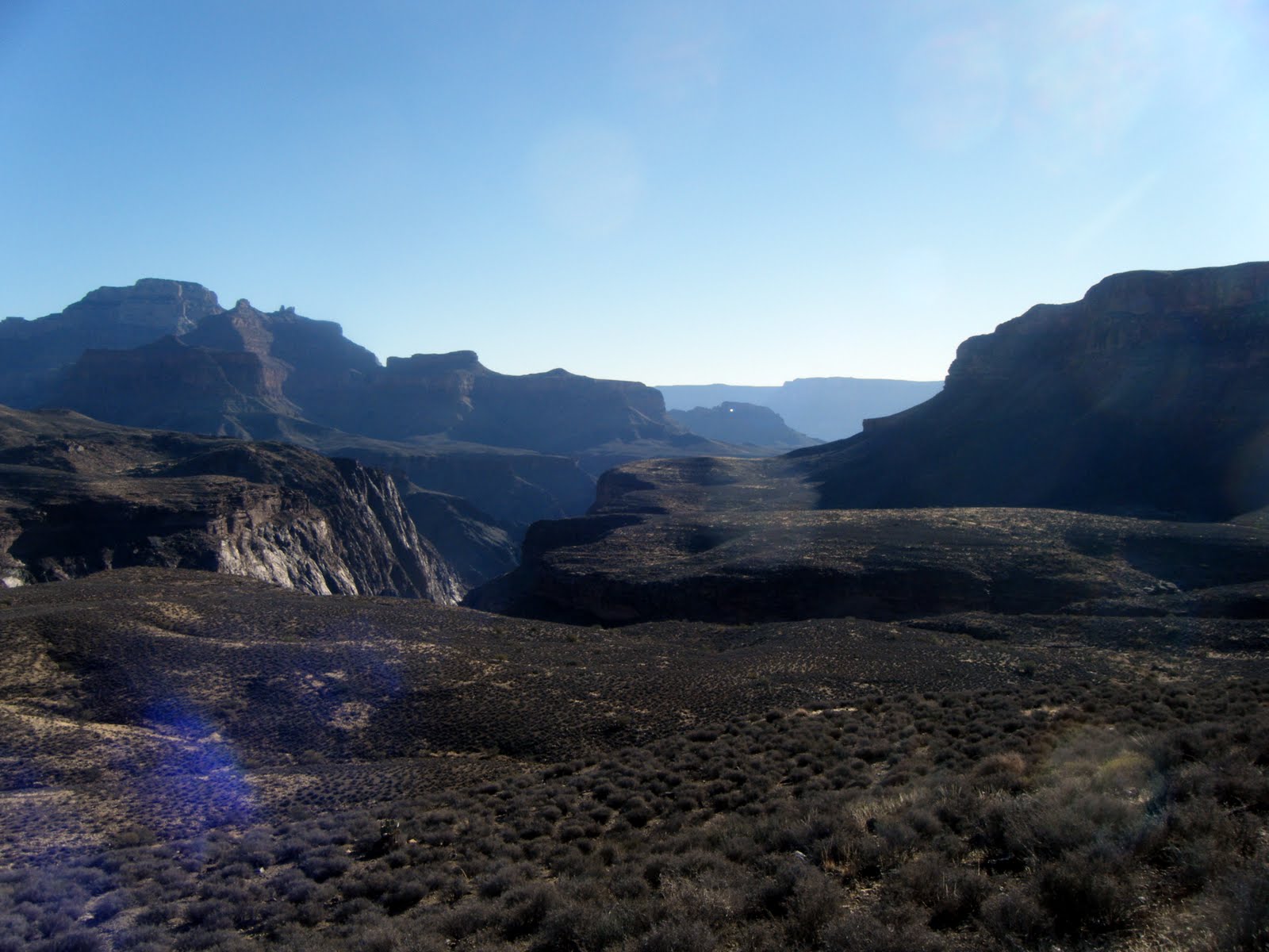
Day One: Grandview Trail to Cottonwood Creek. 11/20/2012
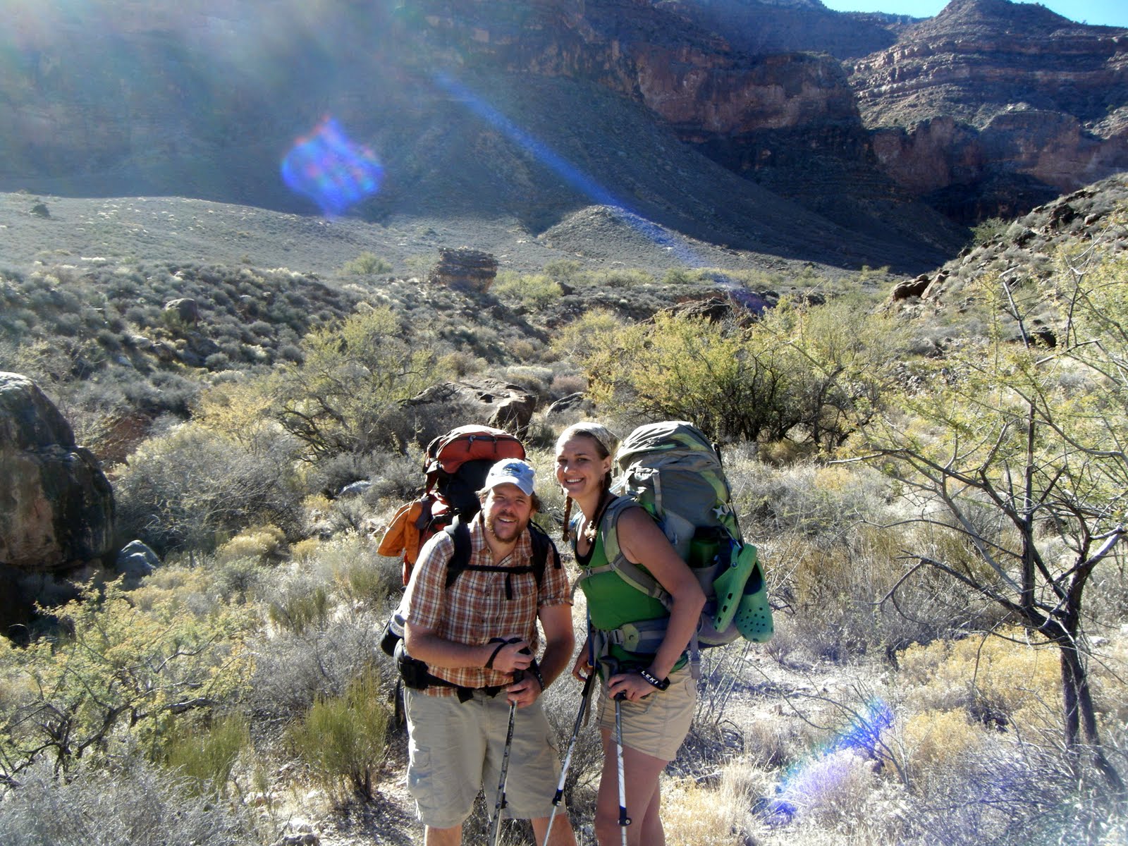
Somehow, Groceries and I managed to get Floyd packed up and ready to leave his home in Prescott Valley, AZ at o'dark-thirty on the morning of our hike. We drank coffee while Floyd drove and arrived at the Grandview Trailhead around 9:30. We dropped the packs and me off at the trail head, and Floyd and Groceries drove the car back to the Backcountry Office to park it. They then hitched a ride back to Grandview. I told Floyd that they would probably get a ride with some European tourist because we know how few American tourists will pick up a hitchhiker. About an hour later, my hiking partners arrived in a carload of Korean tourists, who, despite having a full car, gladly made room for Floyd and Groceries.
 |
| Our benefactors. |
The 3 mile descent to Horseshoe Mesa dropped off quickly, with 2500 feet of elevation loss. Our packs were heavy with lots of food (I can only imagine what Floyd's big red pack weighed), and as always, the descent was brutal on my legs. When we arrived at the historical mining area at Horshoe Mesa, we were ready to kick back, eat some of the pizza that Floyd packed in, and rest a spell. I chose to hike around the mesa and explore a bit. I didn't really find any of the old mines, but I didn't really know where to look. I will definitely return to this place some day and spend more time exploring.
 |
| Grandview Trail. |
 |
| Grandview Trail. |
 |
| Hiking down to Horseshoe Mesa. |
 |
| On Grandview. | | | |
|
|
 |
| Hometown and Groceries chillaxing on the mesa. |
 |
| Horseshoe Mesa. |
 |
| Horseshoe Mesa. |
 |
| Camping? Water? X-ray? |
.
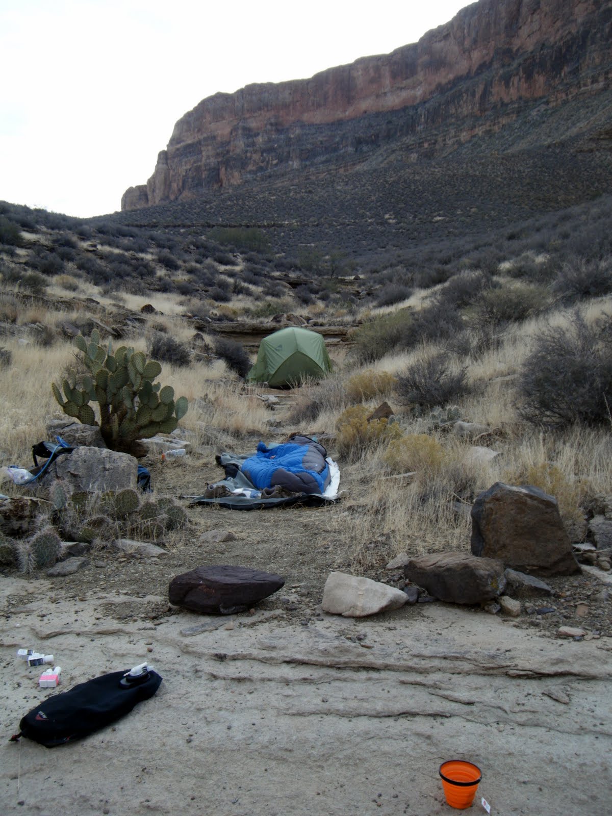
Next, we dropped another 1000 feet in elevation on the steep jump down to the Cottonwood Creek area. The trail was generous with scree in areas and it was difficult to stay upright. It made hiking a challenge, but somehow, we managed to survive without a fall.
We found a nice camping area near the water and among the pretty yellow-leaved cottonwood trees.
At home, in North Carolina, my new granddaughter, Katherine was born. A great day, indeed.
 |
| Trail to Cottonwood Creek. |
 |
| Cottonwood Creek. |
 |
| Cottonwood Creek camp. |
Day Two: Cottonwood Creek to Grapevine Creek. 11/21/2012
After
a wonderful cool night (around 40F
degrees) and a leisurely breakfast, we headed out of camp. I was in front, trail finding, followed by Groceries and Floyd. We followed the creek drainage out and started heading across the plateau. We were supposed to meet up with the Tonto Trail and hike to the west. I noticed that the canyon was forming to our left (the west) and I said to Floyd, "How do we wind up over there, if we're hiking over here?" Floyd's Zen master-like response was something like, "Never question the Tonto; the Tonto knows what it's doing." I guess magically, perhaps? We continued on this way for a couple of miles, thinking we were on the right tract, when at last, it became painfully clear that we were heading in the wrong direction. After pulling out maps and shaking our heads, there was nothing left to do but turn around and backtrack, so that is what we did.
 |
| Cottonwood Creek. |
 |
| The Tonto. |
 |
| A Cottonwood. |
 |
| "The Tonto knows" |
|
The thing about Grand Canyon hiking is that it is time consuming. You can't pound out the miles like you can on some sections of the A.T. Miles mean nothing. First of all, you are so in awe of the beauty that you spend lots of time just standing and gawking. The terrain can also be very difficult and dangerous, and getting in a hurry can get you seriously injured, even killed. Also, you have to really take your time route finding in many areas and frequently consulting maps to identify the landmarks to know where you are. It's a learning curve. So, saying all of that, those extra 3 or 4 miles burned up some daylight.
When we got back to Cottonwood Creek we found a beautiful sign pointing the way on the Tonto Trail. We must have just stepped off the trail about 10 feet in front of the sign and never saw it.
 |
| WTF? |
We ate a bite of lunch and started to tackle the Tonto Trail into the Grapevine Canyon. What I didn't fully appreciate at the time about Grapevine Canyon is that it is absolutely huge. If it was not just a "side canyon" off the Grand Canyon, it would be a major attraction in itself. Our goal was to continue hiking towards Grapevine Creek, find water, and a camping spot before dark. Oh yeah, not getting lost or getting injured was high on the agenda, too. We weren't sure at this point if we could make it before dark, but we were determined to try.
As we hiked, the trail itself, at times, became quite exciting. We admonished each other to be extremely careful as we hiked along the side of a short downward slope that would quickly turn a slight trip or misstep into a 1000 foot sheer drop off into the bottom of Grapevine Canyon. As we approached these treacherous sections, we suddenly found that the hike mentality had changed. All attention was on our footing, we spread out on the trail, we quit talking, as we realized that there was no room for error. Like I said, things got exciting.
 |
| Canyon hiking. |
 |
| Back on Grapevine. |
 |
| Awesome Grapevine. |
 |
| Precarious! |
 |
| No room for error. |
 |
| Hometown wildlife! |
The sun was quickly fading, as we approached another precarious section of the trail. Floyd called from the rear position asking if we wanted to continue. As there was no place to throw down, and no water, we said, "Let's keep going". We took numerous unsuccessful side trips exploring dried-up springs, as it became too dark to see, we strapped on headlamps. We hiked on the edge of dark oblivion. It was just another outing with trip-leader Floyd.
Finally, we heard and then found water in a small creek cutting through the trail. We stumbled around in the dark, trying to find a camping spot and finally hiked back about 50 yards and set up on a flat and dry creek bed. It was perfect. I decided to cowboy-camp and lay beneath the beautiful starry sky. I fell asleep watching meteorites flash across the heavens. Ahh!
Sometime during the wee hours of daybreak, ravens attempted to attack my pack. I shooed them away.
 |
| First Grapevine Camp |
Day Three: Grapevine Creek. 11/22/2012
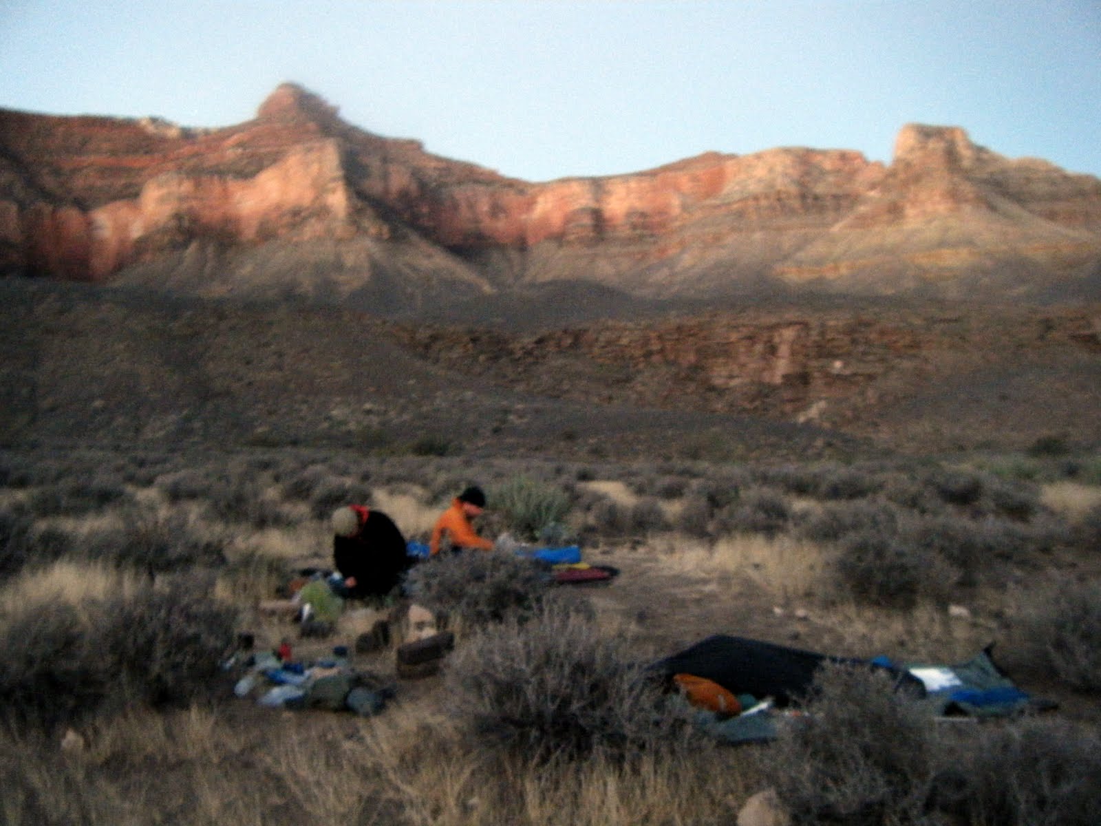
Thanksgiving Day! We had a "zero" day scheduled for this day. That means we had a second night of camping in the Grapevine Creek area scheduled and essentially had "zero" miles to hike today. We slept in and hung out, eating, drinking coffee, telling stories, and generally chilling. We didn't have much on the agenda today. In the late morning, a lone hiker approached on the Tonto, heading west. He stopped to talk and ended up visiting with us for over an hour. His name was Eric, he was from Canada, and he had completed several long section hikes on the A.T. We found out that Eric had camped at Grapevine Creek the night before (I thought we were at Grapevine). He said it was about 45 minutes further east. We enjoyed his company and conversation.
 |
| Photo by Eric. |
After Eric departed, we packed up and hiked the 45 minutes around to Grapevine Creek. It was a beautiful and ideal setting at the head of this deep and remote canyon. The water was lovely with several nice pools. After looking around, we decided to cowboy camp on the flat rock on the creek's edge. It was a good decision, because no sooner had we finished scouting it out, the first couple, of a party of 8, flew into camp and were quickly throwing down, without giving us the courtesy of inquiring what our camping plans were. We thought that was somewhat rude and inconsiderate, showing a real lack of backcountry etiquette, but we thought we would give them the benefit of the doubt. Probably city folk, what can you do? We tried to engage them, but they seemed to have little desire to interact with us.
We set up camp on the stream bed, filtered water, and started our Thanksgiving feast. We smeared tortillas with Grocery's delicious homemade guacamole and piled on peppers, sprouts, and cheese. We made and ate stuffing with dried cranberries. We fixed mashed potatoes and doctored them up with goodies. I brought Turkey Spam and fried it up. We snacked on turkey jerky. Groceries made chocolate mousse and raspberry crumble. We ate til we were stuffed. We drank coffee. Life was good at the head of Grapevine, deep within the Grand Canyon.
 |
| Thanksgiving camp. |
 |
| Floyd, one leg in, one leg out. |
 |
| Looking down on camp, from the ledge above. |
 |
| Camp life. |
 |
| Turkey Spam! |
 |
| Groceries getting excited about Spam. |
 |
| The hit of the hike, Grocery's guacamole! |
 |
| Camp life with Groceries. |
|
I was glad that I was getting to spend some awesome trail time in such a beautiful setting with such great friends, but at the same time, I couldn't help thinking about my family enjoying their feast without me. And my new little granddaughter, whom I had yet to see.
That night, while trying to catch some zzzzs in our bags, beside the creek, our neighbors must have been drinking liquor and got louder and louder and louder. It really was somewhat of a spoiler to the serenity of Grapevine. Fortunately, the festivities didn't last too long and they soon went to bed.
Sometime during the wee hours, ravens knocked some of my stuff sacks off the ledge. Nothing seemed damaged or missing.
 |
| Floyd actually carried math, with him. Did I mention the horseshoe and hockey puck? No, I didn't. Don't encourage him, you know. |
 |
| Nice Grapevine water. |
Day Four: Grapevine Creek to Cremation Creek. 11/23/2012
We rolled out of bed in the cool morning twilight. We had a long and dry day of hiking ahead of us and a dry camp at night. Eric had told us earlier that there was water about 5.7 miles ahead at Boulder Creek. We knew the rest of the hike was dry. Could we find the water? Would we know when we were at Boulder Creek? We weren't really sure, so we filtered up and packed out. I carried 4 1/2 liters. Floyd must have had 6 or more. Groceries had her hula hoop full. Did I mention her hoop?
 |
| Canyon hooping. |
 |
| Fun times in the canyon. |
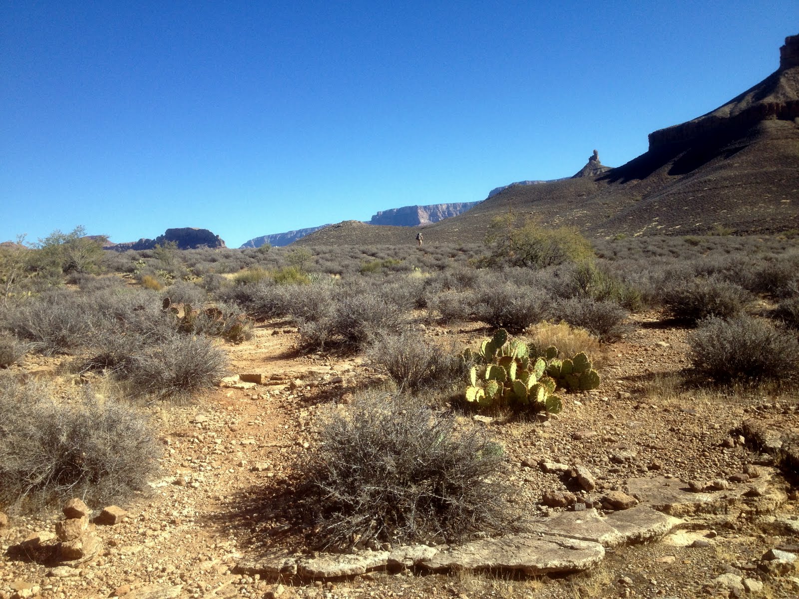
We worked our way around the west side of Grapevine. We stopped after a while to take a break on the high Tonto platform and Groceries broke out her backpacking hoop for a spin.
This was some sweet Tonto hiking. High above the canyon, we wound our way between the cactus and over the lava rock. Before long, the brown and muddy Colorado River was in view at the bottom of the deep gorge, and we started skirting Lyle Butte and heading into the Boulder Creek Canyon.
 |
| Nice! |
 |
| Canyon back country. |
 |
| Deep Grapevine gorge. |
 |
| Not many of these around western North Cackalacky! |
 |
| Nice one. |
 |
| Looking down at the river. |
 |
| The big thumb that I now will always associate with the west side of Grapevine. |
 |
| Tonto Trail. |
Here, I started paying close attention to the distinctive three "arms" of the butte and easily figured out where the trail would cross Boulder Creek. When I arrived, I dropped my pack and hiked about 75 yards up the dry creek bed and found nice, pump-able water. Groceries and Floyd joined me after 30 minutes; we filtered water, cameled up, topped off our bottles, ate lunch, and moved on.
 |
| Floyd and Groceries. |
 |
| Canyon hikers. |
 |
| Tonto. |
 |
| I love the Tonto. I think the Tonto loves me. |
 |
| Inner gorge. |
 |
| Tonto hiking. |
Next, we followed the Tonto back out to the inner Colorado Gorge and then into Lonetree Canyon. Lonetree was, as reported, dry. As evening approached, we found a truly awesome and magnificent camping spot in the Cremation Creek area, high on the Tonto platform, with the mighty and aptly named Zoroaster Temple looking down upon us from across the river. What a front porch view! We threw down cowboy style and marveled at the glorious Grand Canyon beauty.
 |
| Wonderful, wacky, Tonto Trail. Look at that sky! |
 |
| Boulder Creek. |
 |
| Miles and miles of smiles (as long as you tote plenty of water). |
 |
| Groceries in the back country. |
 |
| Floyd, looking cute. |
 |
| Hombres of the Canyon. | |
We saw no other people today, after leaving camp.
 |
| Zoroaster Temple. |
 |
| Cremation camp! |
 |
| Losing the sun in the canyon. |
 |
| Moon. |
 |
| Camp. |
Day Five: Cremation Creek to South Kaibab. 11/24/2012
This was our hike-out day. This Tonto trail section from Cremation to the South Kaibab intersection was difficult. It involved many steep ups and downs through lesser canyons, with lots of little lava rock scree to make things dicey. I think I saw Groceries go down a couple of times. It reminded me of the good old White Mountains, without the rain!
Before long, we were at the big privy which signaled the intersection of the South Kaibab trail. Actually, it was more the circus atmosphere, which announced the S. Kaibab. There appeared a full mule train of tourists wearing cowboy hats and chaps, their guides and mule wranglers, day hikers, and jocks, and even a backpacker or two.
I felt just like I did when Segue and I had to feed the Nancies some corn at Lake of the Clouds hut, one time, long ago.
Groceries told me that Floyd was secretly looking for a juggling unicyclist. I'm not sure what that was all about.
 |
| Hike across Cremation. |
 |
| Mule train. |
 |
| Floyd never met a privy, that he didn't appreciate. |
 |
| This mule wrangler took the time to ask us about our trip. Nice! |
 |
| Groceries hopping up the Kaibab. |
 |
| Looking back down towards Cremation. |
 |
| South Kaibab switch backs. |
 |
| Canyon hikers extraordinaire! |
 |
| Aptly named. |
 |
| Groceries looking like it took no effort. |
 |
| Floyd looking for attention. |
We talked it over and decided we had enough water to make it out. We climbed the S. Kaibab, through the switchbacks to the top. In places, it gained elevation quickly. Being a main corridor trail, the crowds got bigger and bigger, as we neared the top. There were several fools climbing on ledges, perching on precarious edges, clowning for cameras, generally taking too many chances. I mentioned to Groceries that one didn't seem to see that kind of risk taking down in the back country. It seemed more like a rim phenomenon.
As we got to the top, a group of elk were hogging the water station. Silly elk, they didn't know that the water was for thirsty Floyd!
 |
| On top, Floyd still toting his beloved big, red, pack. |
 |
| Elk drinking Floyd's water. |
We rode 2 crowded buses back to the back country office. As we departed the bus, I was grabbing the packs off the rack in the front of the bus and handing them out the door to Groceries. I pulled hers off, no problem. I pulled mine off, no problem. Finally, I attempted to grab Floyd's. Nothing happened. I grabbed it again, I couldn't budge it. I yelled out the door, "Floyd, you're gonna have to get this pack". I couldn't budge it! He hopped on the bus and grabbed it. Ha ha! I guess I'm just a light-weight backpacking weenie!
Loading our packs into our car, we were surprised by our Canadian friend, Eric. He just happened to be there, after hiking out the day before.
 |
| Eric trying on the infamous "Big Red Pack". |
What synchronicity! He joined us for a post-hike celebration meal at the Bright Angel Lodge.
It was a fitting end to a wonderful hike with great friends.
 |
| Groceries, Boy Floyd, Eric, Hometown at the Bright Angel Lodge. |